
Killeen Neighbors by Parcel
The Killeen public record can describe the block around a Killeen address without making a household list. Killeen GIS supplies parcel shapes, street context, structures, and boundary layers. Bell CAD supplies Killeen appraisal-owner, mailing, situs, and parcel leads. The Killeen-related Clerk index can document dated ownership and lot or subdivision language. Each source answers a narrower question than “who lives here,” which is why a Killeen neighbors search should begin with the parcel relationship.
| Block Source | What It Shows Nearby | Access Route |
|---|---|---|
| Killeen GIS Parcel layer | Killeen parcel polygons, streets, city or county context, and mapped structures | Public Killeen map with Identify, Find, and query tools; no occupant roster |
| Bell CAD for Killeen parcels | Killeen appraisal parcel owner, mailing lead, situs, values, and exemptions | Public Killeen eSearch route; compare the legal description |
| Bell Official Records for Killeen | Dated Killeen owners, plats, liens, and legal descriptions | PublicSearch for Killeen and custodian copy route |
| Killeen voter-list request | Potential Killeen registration fields subject to statute and redaction | SOS request form; not a casual Killeen street browse |
| Killeen HOA information | Killeen property-code context and a public city contact | Killeen city explanation; no member or officer directory located |
| Killeen directories and yearbooks | Historical Killeen address observations for a dated edition | Killeen library, Historical Society, UT, or TSLAC route |
Killeen ownership and occupancy are not interchangeable. A tax notice can go to an owner, agent, lender, or institution away from the parcel. An old Killeen directory can show a household at an address in its publication year, but not today. Use a source date with every Killeen neighbor lead. Note: The Killeen block relationship comes from contiguous parcel boundaries, not from a broad name search.
Killeen Neighbor Map Method
The Killeen GIS MapServer is the geographic starting point for a Killeen block. Its documented layers include Parcel, StreetCenterline, Citylimits, Bell County Roads, Bell County Boundary, Bell County Cities, Structures, parks, and Council Districts 2024. Use StreetCenterline and Parcel to find the relevant Killeen segment, then use Identify on the target parcel and each contiguous polygon. The service supports Find, query, layer toggles, pan and zoom, and map export, but no verified public radius or household layer was located.
Record a Killeen parcel ID and the direction of adjacency before looking for an ownership lead. North, south, east, west, or rear adjacency can be more reliable than an assumed street sequence on an irregular Killeen lot. Killeen’s older downtown lots can be long and narrow because the original Santa Fe plat covered 360 acres and 70 blocks. A deep parcel may reflect that historic geometry rather than a mapping error.
Parcel-to-document path. Move from a Killeen GIS parcel to CAD property or geographic ID, then to the Clerk index by owner, subdivision, legal description, or document details. That Killeen chain is more defensible than guessing from a modern address alone.
Killeen Neighbor Ownership Leads
Carry each Killeen GIS parcel ID to Bell CAD eSearch for Killeen parcels. The CAD search exposes owner name, street number, street name, property ID, geographic ID, property type, subdivision, tax year, and advanced filters. Keep the Killeen situs address, owner, mailing address, legal description, and tax year as separate fields. A local mailing address does not prove that the owner lives on the parcel. A nonlocal mailing address does not identify a current occupant either.
For a dated ownership event, use Bell Official Records. Search a current owner as grantee around the acquisition date, extract the seller, recording date, instrument number, subdivision, and legal description, then compare that description with CAD. A plat links an address to lot and block language. When an address and legal description do not align, check for a replat, parcel split, combination, annexation, trustee deed, probate filing, or entity-name change before connecting the records.
This is the key limit for Killeen neighbors: a CAD owner or deed grantee is a dated ownership lead, not a public declaration of who occupies the property. Killeen GIS likewise maps parcels without enumerating household occupants.
Killeen Neighbor Voter Boundaries
Texas My Voter Portal is an individual registration-status tool, not a public browse for everyone on a Killeen block. The official portal describes VUID plus date of birth, Texas driver license or personal ID plus date of birth, and first-and-last-name routes. It should be used only for a current self or otherwise authorized status question, with protected information left private. Registration or voting history is not a complete address history, and participation history never reveals a ballot choice.
A statewide or county voter-list request is a separate process. The Secretary of State public-information form provides CD-ROM or FTP delivery options, fixed-width text format, and active or suspense inclusion choices. Texas Election Code Section 18.009 prohibits use of a voter list for commercial advertising or promoting products or services. The exact released fields, list vintage, suppressions, and costs depend on the request and legal limits.
Bell Elections is the county channel for registration questions: Elections Administrator Desi Roberts, 550 E. 2nd Ave., Belton, TX 76513, 254-933-5774, Elections@BellCounty.Texas.gov. Call before a visit because research did not locate walk-in list-terminal hours. Protected voters and Address Confidentiality Program participants must not be located through other fragments.
Killeen Neighbors and HOA Information
Killeen’s official HOA resource explains Texas Property Code Chapters 202 and 209. It does not publish association names, officers, member rosters, or a neighborhood directory. A deed restriction is a private restrictive covenant, not city zoning, and most HOA restrictions are enforced by private parties or associations rather than the city. Use the city route for legal or development context, not for a private contact list.
The City of Killeen HOA page is the source for this Killeen neighbors image.
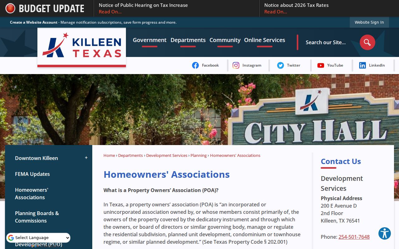
The city page demonstrates the public legal-information route. It should not be read as a member directory.
City Development Services
Public development and restrictive-covenant context: 200 E. Avenue D, second floor, Killeen; 254-501-7648. This office is not an association-member directory.
Bell County Historical Society
Its in-house Gateway Index, yearbooks, phone books, local history, and family-history material are available after a Research Topic Form and appointment, not as a neighborhood roster.
No complete public Killeen association inventory, block-watch list, congregation directory, or civic-club roster was found in the official research. Verify a current organization through its own intentionally public contact channel.
Map a Killeen Neighbor Block
Follow the immediate block rather than extending a search across an entire named street. This keeps the work tied to visible parcel geography and avoids inventing a radius roster. For the broader street-by-street record chain, use the Killeen street address directory after the adjoining parcels are identified.
- Locate the target street address in Killeen GIS and identify its parcel. Save the parcel ID, street spelling, map date, and any direction of adjacency.
- Click each contiguous parcel separately. Compare the visible parcel shape and street-facing location instead of assuming the next address is adjacent.
- Run each parcel or geographic ID in Bell CAD. Record owner and mailing information as appraisal leads, then preserve the legal description and tax year.
- Search the Clerk index for a dated instrument when ownership needs confirmation. Compare subdivision, lot, block, recording date, and instrument details before linking a deed to the parcel.
Permits and code cases can be address keyed, yet neither establishes a resident. Killeen Building Inspections uses MGO Connect for permit activity, while Code Enforcement concern records are allegations or case activity that may need a Texas Public Information Act request for the underlying existing file. Distinguish complaint, inspection finding, notice, citation, and resolved status.
Killeen Neighbor History by Year
Historical block research needs year-specific wording. Killeen Sanborn sheets at the Library of Congress cover January 1926 through September 1937 and can show building footprints, materials, street or block relationships, and adjacent structures. They do not prove title, occupancy, or identity. The Library of Congress Killeen Sanborn item is useful for translating an older block to a modern GIS parcel.
Directories, newspapers, yearbooks, cemetery material, and deeds can add a dated observation. The Texas State Library and Archives Commission lists Killeen directory holdings for 1963, 1982, and 1990. UT’s Polk index lists 1965, 1970, 1972, 1974, 1976 through 1981, and 2003. Those are separated observations, not a continuous run. Say that a household was “listed at the same block or address in 1976” when the source supports it, rather than claiming a present neighbor relationship.
Postal ZIP labels do not define a Killeen block or association. Keep the ZIP, mapped city limits, situs, mailing city, and historical military-area label in separate columns when comparing old records.
Killeen Neighbor Privacy Limits
Renters, household members, visitors, utility subscribers, delivery recipients, protected victims, confidential voters, juvenile information, and private association contacts are not a reliable public block field. The Texas Address Confidentiality Program provides a substitute mailing address for qualifying participants. Protected voter information cannot be reverse-engineered from a parcel map, CAD row, directory entry, or other indirect records. Keep screenshots blank or redacted and do not publish a private person’s full mailing address merely because a database displays it.
A comparison makes the limit clear:
| Official Block Sources | Commercial Neighbor Tools |
|---|---|
| Show a custodian, document date, parcel role, and stated access limit. GIS, CAD, and recorded instruments can be checked against their original source. | May combine public indexes, marketing data, and name associations. Results can be stale, conflated, or affected by opt-out limits. |
| Do not turn owner, voter, permit, or deed data into an occupancy roster. Restricted data stays restricted. | Do not override Texas confidentiality, motor-vehicle limits, utility privacy, or Address Confidentiality Program protections. |
Lawful use. Use Killeen neighbor records for personal, lawful research, local history, reconnecting, or understanding a parcel relationship. Never use records to watch, stalk, harass, intimidate, or harm another person.